Basque Country, Spain
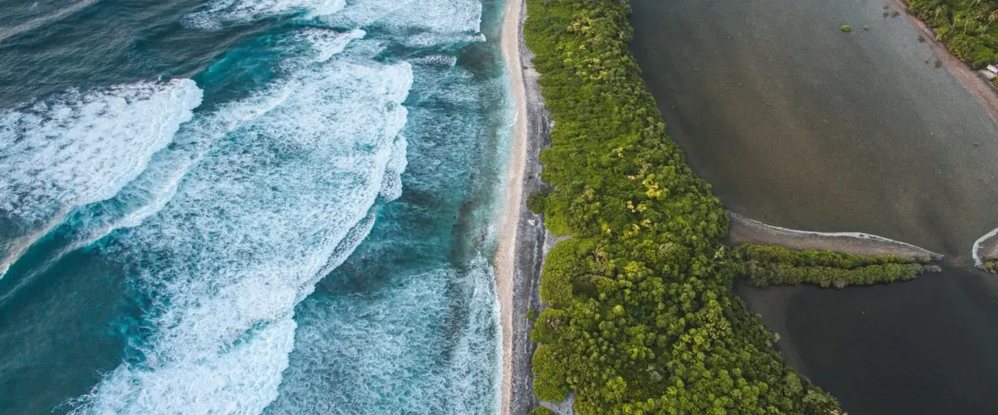
An autonomous community located in the northern part of Spain and the southwestern part of France, Basque Country is known for its diverse culture and landscapes. Like many regions around the world, Basque Country also faces challenges from natural hazards such as flooding, erosion and landslides. Under climate change, these hazards are likely to be exacerbated, resulting in increasing impacts as well.
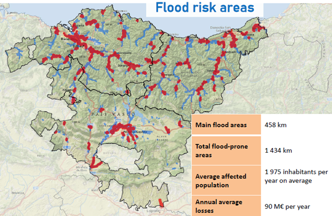
Owing to the region’s topography and steep relief, this makes the region prone to flash floods (see Figure 2‑2) during periods of heavy precipitation, and in some cases, the response time can be on the order of less than 1 hour. In recent years, there have been several severe flood events that have caused infrastructural and economic damage in Basque Country, such as the November 2021 floods. Urbanised areas are especially vulnerable owing to the dense urban planning and impact on populations and infrastructures. The Basque Water Agency (URA – Uraren Euskal Agentzia) is responsible for flood mitigation, protection and preparedness within the region, who are also the end users within this project for the Basque Country case study. They focus on four main pillars in their flood management strategy: Prevention, Protection, Preparation and Recovery & Evaluation.
User

The Basque Water Agency (URA) is an entity of the Basque Government tasked with the role of carrying out the water policy in Basque Country, including management of water quantity, quality and safety. Due to the long history of flood occurrence in the region, one of the strategies URA undertakes is to promote co-existence with floods, and where needed, flood mitigation measures such as urban planning and protection.
Current forecasting infrastructures
Currently, Basque Country has two systems in-place to support timely delivery of actionable information.
SAIH (Automatic Hydrological Information System): A network of meteorological and hydrological data collected from a network of more than 130 measurement stations. Several agencies contribute to this system, resulting in a robust collection of monitoring data.
UHATE (Hydrological Prediction and Alert System): A real-time forecasting information system that provides emergency services with information on the probability of hydrological flows to support rapid decision-making. The hydrological forecast is based on real-time data and meteorological forecast, based on a dense monitoring network of over 220 stations and buoys.
In the event of a flood event, a close collaboration between the Basque Water Agency, Euskalmet (Meteorological office of Basque Country) and Civil Protection collaborate and take part on the emergency committees for disaster preparedness and evacuation.
Local digital twin implementation
The model chain for Basque Country includes a sub-selection of models from the full DestinE Modelling Framework (see Figure 2‑3).
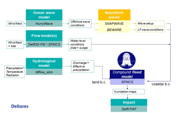
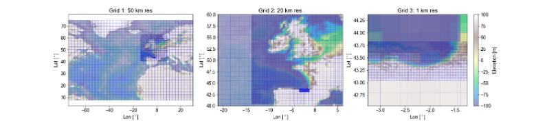
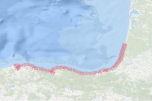
High-resolutions Hurrywave models were implemented for the coastline of Basque Country (see Figure 2‑4 to simulate the generation and propagation of sea-swell waves and local wind waves by strong wind. The model is build based upon the global GEBCO19 bathymetry dataset and forced with wind fields from the IFS system.
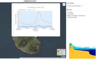
For the simulation of nearshore waves a BEWARE model was implemented. Hereto coastal transects were extracted from the JRC database. BEWARE is forced with waves from HurryWave and water levels from Delft3D-FM.
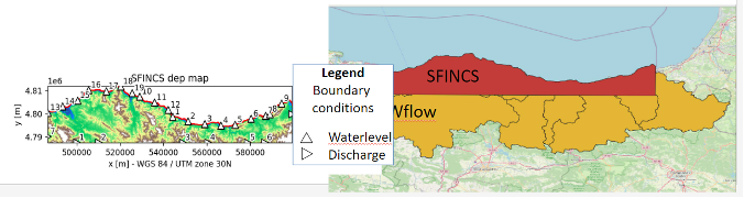
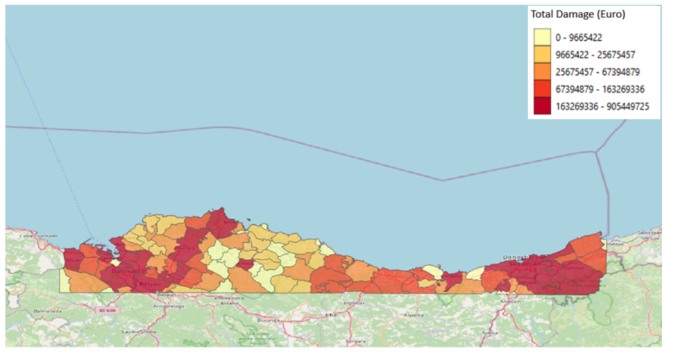
To simulate flood depths and extents the SFINCS model was implemented (Figure 2‑6). The flood map depth maps have been used as input for Delft-FIAT to estimate the damage that was aggregated to admin areas.
Together with Tecnalia we will work on the validation of the results. Tecnalia will collect discharge and water level observations.
Partners

Tecnalia is the largest center of applied research and technological development in Spain and a member of the Basque Research and Technology Alliance, focusing on the use of technology for societal improvement. Tecnalia regularly works with URA on the development and improvement of the current Delft-FEWS forecasting system for the Basque Country. Within this project, Technalia will support the data exchange and user interaction with URA.