La Reunion, France
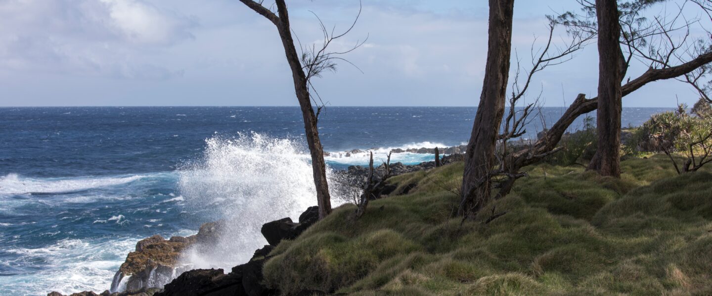
The island of La Réunion is a French overseas department situated in the western Indian Ocean and home to the highest peaks in the Indian Ocean. Due to its geographical location and topography, the island experiences several natural hazards such as cyclones, landslides, and coastal and inland flooding. The island holds records for some of the most extreme rainfall events as a result of these cyclones. Some of the most damaging events included Cyclone Denise (1966), Gaméde (2007), Fakir (2018) and Berguitta (2018). During a cyclone, the low-pressure system generates extreme precipitation, storm surge and swells. Combined with its mountainous terrain and exposed coastline, the island is susceptible to flash floods in low-lying areas from both inland and coastal compartments. Floods have socio-economic consequences for the island, such as population safety and damages to businesses, assets and infrastructure.
To overcome compound flood hazards, the island has implemented various measures including early warning systems, land use planning and infrastructure improvements. However, the unique geographical characteristics of La Réunion presents ongoing challenges in managing these hazards and protecting vulnerable communities. Currently, emphasis is placed on ensuring a good and reliable forecasting system is in-place. In this respect, DEAL (Direction de l’Environnement de l’Aménagement et du Logement de La Réunion) is the primary agency responsible for flood forecasting and management on the island, and is the La Réunion user within the DE370A_Deltares project.
User
DEAL is the department of environment, planning and housing of La Réunion. In particular, the Cellule de Veille Hydrologique (CVH – Hydrological Watch Cell) is responsible for flood forecasting, flood vigilance, evacuation and mitigation. With a total of 8 agents stationed on the island and 29 monitoring stations for 17 sub-catchments, DEAL is primarily interested in robust forecasting results to support rapid evacuation or intervention if needed.
Current forecasting infrastructure
Currently, two flood forecasting systems are running for the island and are being managed by the CVH team in DEAL. These are:
- Génie Rural Prevision (GRP): consisting of a global hydrological model with flow rate assimilation
- Spatially distributed Modelling and Assimilation for Hydrology (SMASH by HYDRIS hydrologie and INRAE)
At the moment, another forecasting system is being developed by Surface Libre for higher detail modelling in 3 sub-catchments, featuring a distributed hydrological modelling routine with local hydraulic modelling for flood forecasting, as well as containing a library of flood maps for different scenarios.
Local Digital Twin implementation
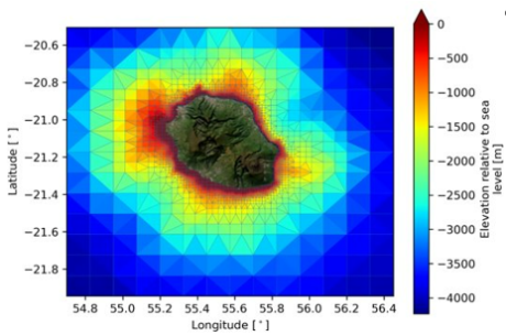
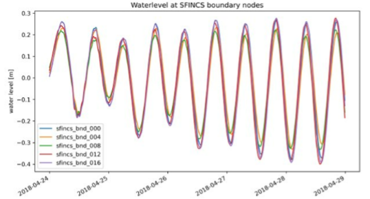
The Delft3D-FM hydrodynamic model for La Reunion was largely automatically generated. The Delft3D-FM model takes the data from the Global Tide and Surge Model (GTSM) as boundary condition, but has a much higher resolution itself. Especially close to the coast the resolution is rather fine to account for local bathymetry variations (see Figure 3‑2).
This Delft3D-FM model supplies surge and local tidal boundaries conditions to the nearshore wave model (BEWARE) and the flood inundation model SFINCS (see Figure 3‑3).
For the simulation of rainfall-runoff processes the spatially distributed wflow_sbm hydrological model is implemented for the entire Island (Figure 3‑4). The model has a resolution of 1 km and provides hourly discharge time-series that are used as boundary conditions for the SFINCS flood inundation model.
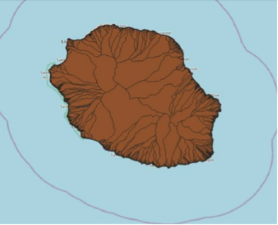
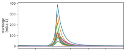
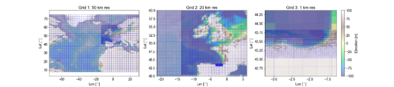
Figure 3‑5 shows the setup of the HurryWave model that simulates the generation and propagation of sea-swell waves and local wind waves by strong wind. The model is build based upon the global GEBCO19 bathymetry dataset and forced with wind fields and atmospheric pressure from spiderweb for the FAKIR event.
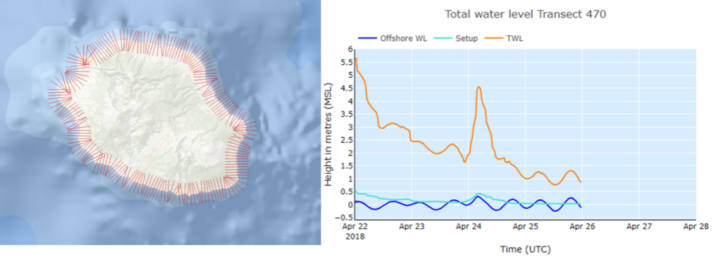
The BEWARE model was implemented for the generation of infragravity waves in the nearshore environment. The model uses coastal transects from the nearshore slope datasets constructed in a collaboration between Deltares and JRC. Figure 3‑6 displays the wave runup (metres) above MSL for cyclone Fakir.
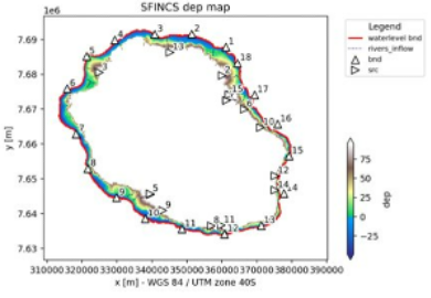
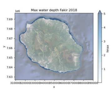
Finally, the SFINCS model is implemented and run using river flow from wflow_sbm and coastal water level data from Delft3D-FM and wave models as boundary condition. The resolution of the SFINCS model is 200 metres. The model domain is based on watershed delineation and elevation. It extends from -50 metres in the sea up to 100 meter elevation over land. Figure 3‑7 displays the SFINCS domain (left) and the maximum water depths over land simulated for the Fakir event (right).
Partners

Surface Libre is a company specialising in consultancy services to provide training and support for hydrological and hydrodynamic modelling. They are currently developing the 3rd real-time modelling system for La Réunion. Owing to their experience working in La Réunion and with DEAL, Surface Libre will be helping to distil and translate user requirements within this project.