Philippines

The Philippines is an archipelagic nation consisting of over 7000 islands, resulting in a highly exposed coastline. The Philippines has an extensive coastline of over 36,000 km, as such, coastal flooding is also a prominent natural hazard in the country. Rising sea levels, storm surges and high tides pose risks to coastal communities. Human practices such as groundwater extraction, land reclamation and rapid urbanisation have all contributed to increasing both the risk and vulnerability of many coastal communities. Located along the Pacific Typhoon Belt, The Philippines experiences an average of 20 typhoons per year. In such an extreme event, heavy precipitation, intense wind, storm surge and landslides result in devastating damages and loss of lives. Past occurrences such as Typhoon Haiyan (2013) Typhoon Melor (2015) and Typhoon Mangkhut (2018) resulted in catastrophic damages to infrastructure, agriculture and communities.
The risk of flooding in the Philippines will likely continue and potentially increase in severity and frequency with climate change. Early Warning Systems are an important tool for Forecast-based Financing (FBF), a mechanism that releases humanitarian funding based on forecast information. Using data-driven and physics-informed modelling approaches, the data modelling arm of the Red Cross (510) uses impact-based forecasting to support the Philippines Red Cross in their humanitarian efforts. As such, 510 is the main user within this project.
User

510 is an initiative of the Dutch Red Cross and is the data modelling centre to support various global Red Cross activities. 510 undertakes a strong data-centered approach and utilises state-of-the-art technology to improve humanitarian aid access and disaster risk mitigation globally, such as machine learning and block-chain technology.
Current forecasting infrastructure
The Red Cross currently has several EWS in-place:
- Riverine flood EWS
- Tropical cyclone risk EWS
- Storm surge flood risk EWS
Their particular interest lies in the improvement of their impact-based forecasts for tropical cyclones in this project. Currently, large potential impacts forecasted will trigger an Early Action Protocol (EAP). The EAP supports the implementation of timely and effective anticipatory actions before a cyclone makes landfall, triggering the Forecast Based Financing (FBF). When triggered, the FBF releases funds for anticipatory actions prior to landfall to reduce the impact of the cyclone. The design of an appropriate EAP trigger is, therefore, highly dependent on the quality of the forecasts of high winds, strong rainfall intensities and potential storm surges and waves associated with typhoons. The impact-based forecast is currently modelled using machine learning methods, combining exposure and vulnerability with hazards such as wind speeds, rainfall, typhoon tracks and other impact data.
Contribution to the DE370A_Deltares project
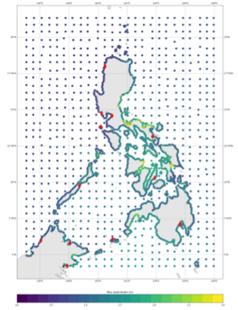
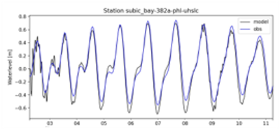
Prior to landfall, the rapid intensification of tropical cyclones makes it difficult to accurately forecast with a 3-day lead time. In addition, some global data products have been found to be unsuitable for accurate impact-based forecasting. The goal is to improve the forecasting capabilities of the various hydrodynamic and/or hydrological models, such that the EAP can be triggered with more accurate impact forecasts to support timely and appropriate humanitarian action. The first simulations have been run for Typhoon Haiyan (2013) with ERA5 as forcing. In addition, surge simulations were conducted based on best track and IFS ensemble tracks. There were only very limited observations available for validation.
Local Digital Twin implementation
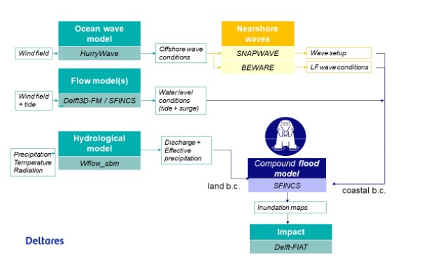
The model chain for the Philippines includes a sub-selection of models from the full DestinE Modelling Framework (see Figure 6‑1).
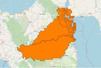
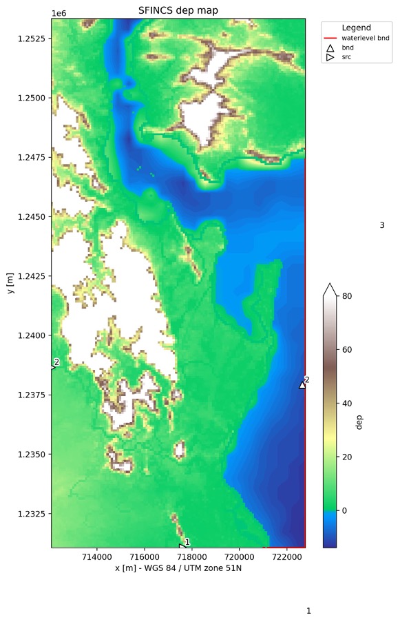
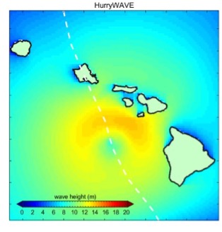
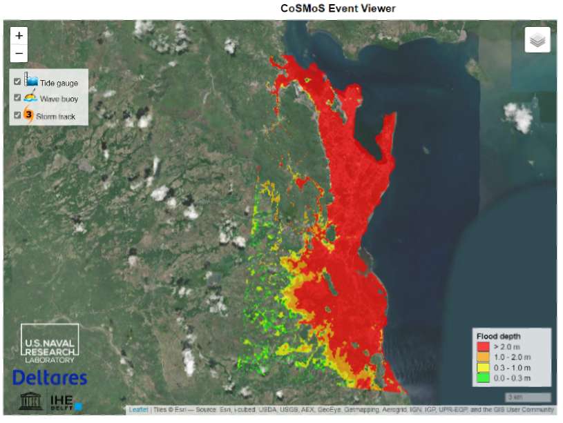
We implemented wflow_sbm for the upstream basin and SFINCS for the coastline around Tacloban (Figure 6‑2) and implemented a Delft3D-FM model for the entire coastline of the Philippines (Figure 6‑3). Wave heights were simulated with HurryWave (Figure 6-4). This resulted in the with SFINCS flood map for Haiyan (Figure 6‑5).