Simulating the Future of Extreme Events
Developing a catalogue of simulated extreme events with information from the high-resolution Climate DT data stream.
In a nutshell
- The objective of the HydroMet application is to provide more accurate statistics of extreme rainfalls and other hydrological extremes, as well as to estimate how climate change might affect future extreme events.
- To achieve this, the application will leverage the capabilities of the Climate DT data stream and will summarise the events in a catalogue.
- The users will obtain access to large amounts of homogenous information regarding past, present and future extreme rainfall events at the local-to-regional scales.
Technical Overview
Challenge
Such hazards as thunderstorms, cloudbursts, floods, GLOFs, heat and cold waves have a devastating impact on communities and the natural ecosystem. Climate variability has further exacerbated the frequency and impact of such events, thereby calling for an improved monitoring and prediction system.
Understanding the dynamics of these phenomena and the associated risks could help closing the knowledge gap and minimising the loss and damage from future extreme hydrometeorological events.
DestinE Solution
The HydroMet application will provide statistics of hydrological extremes and estimates of the possible changes induced by climate change in future extreme events. This will be made possible by identifying extreme rainfall events in the Climate DT data stream, that ultimately will be summarised in an event catalogue.
The use case will provide information about, for example, the spatial and temporal extent of an event, precipitation amounts and return time, the frequency of an extreme event in a particular area.
The application is based on two different codes developed by the German Meterological Service Deutsche Wetterdienst (DWD), that has done considerable efforts to anticipate excess rain since several decades.
- KOSTRA2020 is the latest version of KOSTRA-DWD, a coordinated effort across Federal states to develop methods for extreme evaluation. The system, developed through three decades, provides data about precipitation levels, duration and the annual return interval.
- CatRaRE or Catalogue of Radar-based heavy Rainfall Events, is a software package able to detect and define extreme rain events and at the same time generate a catalogue with meteorological and geographical information for each event.
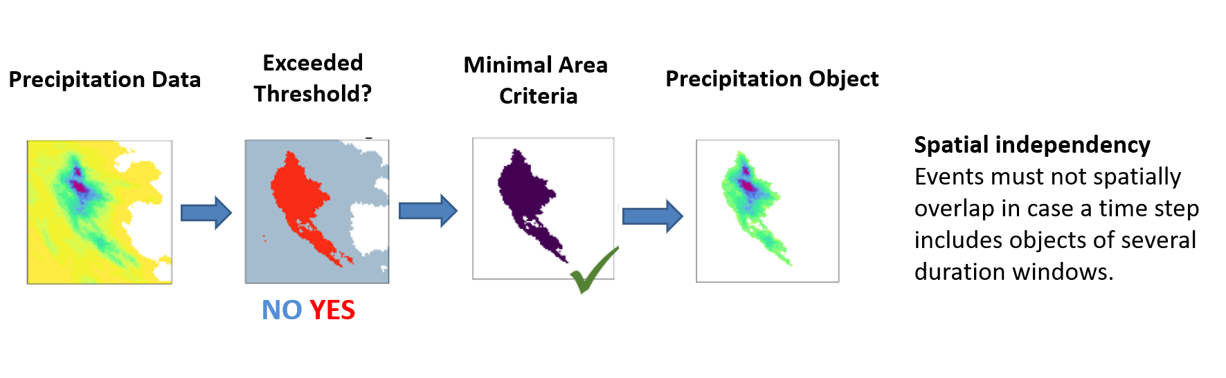
Schematic overview of the two criteria that define single events. Spatial independency
Impact
With these powerful tools as a starting point, the use case will adapt the software to extract the relevant information from the high-resolution Climate DT data stream, generating a catalogue of simulated extreme events that will extract information about the size, duration, intensity and other variables of these simulated flash floods or extreme precipitation events.
Therefore, the application will allow users to obtain large amounts of homogenous information and past, present and future extreme rainfall events at the local-to-regional scales where the impacts are felt and the adaptation decisions are taken.
DAS-Basisdienst “Klima und Wasser”, the German operational coordination framework for adaptation strategies on Climate and Water is the main use identified.
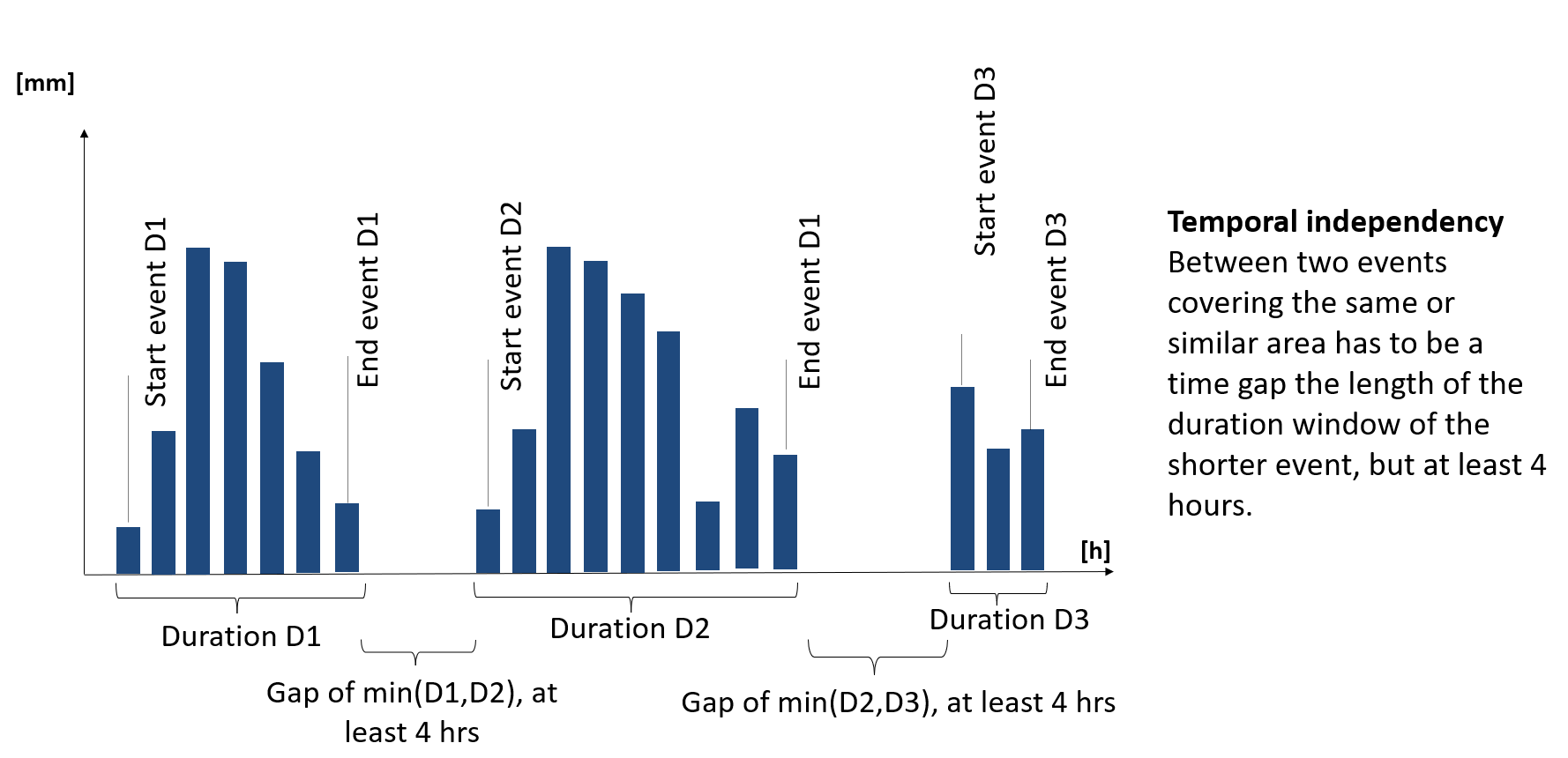
Schematic overview of the two criteria that define single events. Temporal independency
Contributions
Providers